ITMB Caribbean Islands East and South Travel Atlas
SKU
9781553415220
Special Price
$16.95
Regular Price
$19.92
ITMB Caribbean Islands East and South Travel Atlas
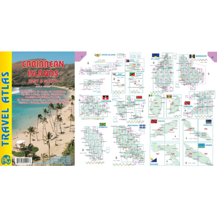
The Caribbean is difficult to map as an entity. It consists of vast amounts of water with dozens of micro-level islands. This Atlas Guide covers the eastern and southern island of the Caribbean all the way down to Trinidad and Tobago. The list of islands included in this atlas is lengthy and includes Barbados, Grenada,Guadeloupe/Martinique, St. Kitts/Nevis, St. Lucia, St. Vincent, and both sets of Virgin Islands, in detail. Like its Western counterpart, this atlas would be an excellent travel companion for anyone cruising the Caribbean (on a huge liner or in a yacht). It has 160 pages of maps and includes 18 town plans. This is definitely the most detailed mapping of the world in existence.
Inset maps of Freeport, Nassau, Havana, Varadero, Georgetown, Kingston, Port Au Prince, Santo Domingo, and San Juan are included. The level of detail is identical with ITMB’s folded maps providing information in a convenient book format, with no loss of detail.
Size: 8" x 5" (21cm x 13.5cm)
# of pages: 160


Featured Products

Explorer Chartbook Near Bahamas 11th Ed.
Special Price
$89.95
Regular Price
$99.92

Italian Waters Pilot Revised 11th Edition
Special Price
$89.95
Regular Price
$94.93

Waterway Guide Northern 2024
Special Price
$52.99
Regular Price
$54.92