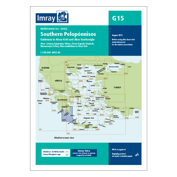
Imray Charts G15 Southern Peloponnisos
SKU
IMR-G15
$42.94
IMR G15 Southern Peloponnisos
Chart scale 1:190 000
Plans included:
Liménas Kalamátas (1:12 500)
Yíthion (1:12 500)
Órmos Kapsáli (1:5000)
Dhiakofti (1:12 500)
Monemvasía (Yéfira) (1:7500)
Nísos Andikíthera to Nísos Kríti (1:190 000)
Imray-Tetra charts for the Ionian and Aegean are widely acknowledged as the best available for the cruising sailor. They combine the latest official survey data with first-hand information gathered by Rod and Lucinda Heikell. The chart is designed to be used alongside Imray pilot guides of the area. Like all Imray charts, they are printed on water resistant Pretex paper for durability, and they include many anchorages, facilities and inlets not included on official charts.
This edition includes the latest official data combined with additional information sourced from Imray''s network to make it ideal for small craft. It includes the latest official bathymetric surveys. There has been general updating throughout.


Featured Products

Explorer Chartbook Near Bahamas 11th Ed.
Special Price
$89.95
Regular Price
$99.92

Italian Waters Pilot Revised 11th Edition
Special Price
$89.95
Regular Price
$94.93

Waterway Guide Northern 2024
Special Price
$52.99
Regular Price
$54.92