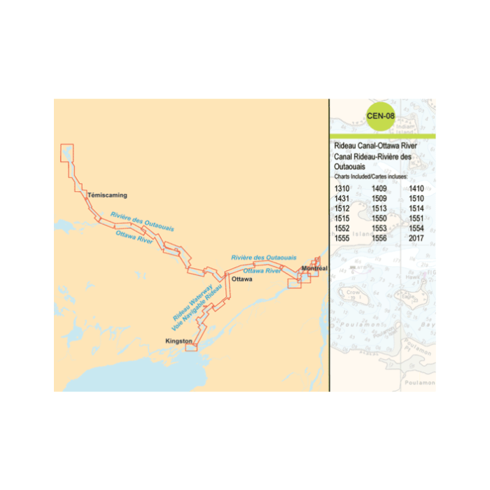
CEN08 Ridwau Canal - Ottawa River - Raster Charts
SKU
RM-CEN08
$49.95
Raster BSB V4 chart coverage of the Ottawa River from Notre-Dame-du-Nord in the north, to Montreal in the southeast. The Rideau Waterway system charts provide coverage between Kingston and Ottawa. Raster BSB V4 Electronic copies of the following paper charts: 1310, 1409, 1410, 1431, 1509, 1510, 1512, 1513, 1514, 1515, 1550, 1551, 1552, 1553, 1554, 1555, 1556 and 2017 Requires Navigational Software. Not GIS compatible. Web Activation required before use, so plan ahead. Canadian electronic charts are installed via an online download with an unlock code. Purchase constitutes acceptance of the DFO Canadian Hydrographic Service End User License Agreement. Product cannot be returned for refund . See Bluewater electronic Return Policy.


Featured Products

Explorer Chartbook Near Bahamas 11th Ed.
Special Price
$89.95
Regular Price
$99.92

Italian Waters Pilot Revised 11th Edition
Special Price
$89.95
Regular Price
$94.93

Waterway Guide Northern 2024
Special Price
$52.99
Regular Price
$54.92