Americas Great Loop Cruise Routes Map 23"X26"
SKU
GLOOPMAP
Special Price
$24.95
Regular Price
$29.92
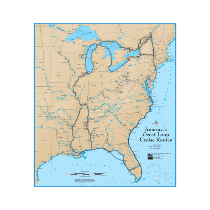
America’s Great Loop Cruise Routes Map:
This poster-sized (23" x 26.5") map shows detail that is helpful when planning the cruise. Features include accurate placement of navigable rivers, locks and dams and major cities and ports. The various routes of the cruise are lightly outlined in colors representing the ideal time to be on each segment – green in spring on the East Coast, orange for summer in the Great Lakes and beige in the fall on the Inland Rivers and Florida's West Coast.
The map is produced in full color on 80# stock and matte-laminated for use with permanent or erasable markers.


Featured Products

Explorer Chartbook Near Bahamas 11th Ed.
Special Price
$89.95
Regular Price
$99.92

Italian Waters Pilot Revised 11th Edition
Special Price
$89.95
Regular Price
$94.93

Waterway Guide Northern 2024
Special Price
$52.99
Regular Price
$54.92