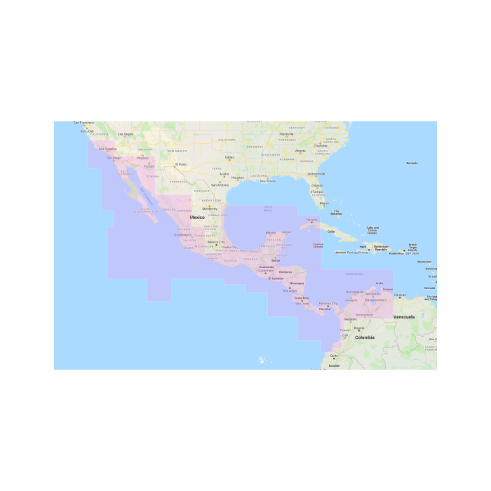
NNA911 Central America Navionics MM3D
SKU
NNA911
$250.00
- SKU: WVNNA911MAP
- Publisher: MapMedia
- Chart Format: MM3D
- Coverage Size:Wide
- Data Supplier: Navionics
- Type: Vector
- Description: CENTRAL AMERICA WEST, CENTRAL AMERICA NORTHEAST, PANAMA TO VENEZUELA From Isla Maria Madre and Puerto Vallarta to Colombia, Ecuador border and through Panama Canal East to Bahia de Danta Marta and northwest to Brownsville, TX.
Click here to download the chart from MapMedia
This chart works with all TimeZero products including Nobeltec, MaxSea and Furuno systems.


Featured Products

Explorer Chartbook Near Bahamas 11th Ed.
Special Price
$89.95
Regular Price
$99.92

Italian Waters Pilot Revised 11th Edition
Special Price
$89.95
Regular Price
$94.93

Waterway Guide Northern 2024
Special Price
$52.99
Regular Price
$54.92