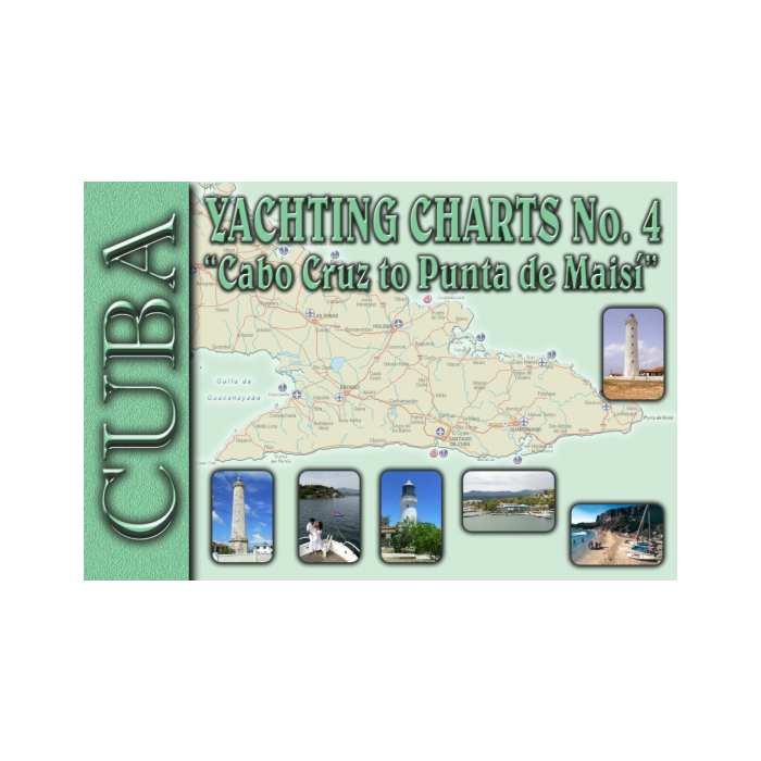
CUBA CK4 Cabo Cruz To Punta Maisi
SKU
CUBA04
$149.95
The Cuban Yachting Charts, commonly referred to as Cuban Chart Kits, consists of a series of 8 chart-books that cover virtually the entire Cuban coast. Each chart-book contains 6 to 12 detailed color charts, which are accurate for use with GPS. The scale of the charts range from 1: 500,000 to 1: 5,000 for selected harbors. Not every harbor is covered, but the most desirable harbors for yachtsmen are included. Each chart displays the depths in meters and the charts include information in both English and Spanish in this chart kit! Cuba CK4 - Cabo Cruz To Punta De Maisi is part 4 of the series. Good graphical representations of the topography when sailing Cuban waters is essential. Each chart is characterized by fine contours and easy to distinguish color graduations of the depth lines. Presented in a handy, user friendly size, enabling the chartkit to be easily accessed or stored. Ensure your adventures to this stunning region is a success with the guide of the Cuban Yachting Charts! Dimensions: 15 1/2 x 22 1/4 '' Chart Index: 4.1 - Cabo Cruz To Ensenada Marea Del Portillo 1: 150,000 4.2 - Ensenada Marea Del Portillo To Punta Bayamita 1: 150,000 4.3 - Punta Bayamita To Bahia De Santiago De Cuba 1: 150,000 4.4 - Approaches To Marlin Marina Santiago De Cuba 1: 10,000 4.5 - Northern Part Of Bahia De Santiago De Cuba 1: 10,000 4.6 - Bahia De Santiago De Cuba To Ensendada Hatibonico 1: 150,000 4.7 - Bahia De Guantanamo To Punta Guayacanes 1: 150,000 4.8- Punta Guayacanes To PUnta De Maisi 1: 150,000 Author: Edimar Nautical Chart Agency Publisher: GEOCUBA Edition Date: 2016 Number of Pages:


Featured Products
Sea of Cortez - A Cruisers Guidebook 4th Edition
Special Price
$54.95
Regular Price
$63.93

Greek Waters Pilot 14th Edition
$104.94

Explorer Chartbook Near Bahamas 11th Ed.
Special Price
$89.95
Regular Price
$99.92