Imray Chart Pack 2300 Dorset and Devon Coasts Wiro-Bound
SKU
IMR2300
$94.94
Imray Charts 2300 Dorset and Devon Coasts Chart Pack Wiro-Bound
A convenient A2 format chart pack of Dorset and Devon Coasts covering waters from the River Dart to the western approaches to The Solent. The pack is provided in a sturdy plastic wallet.
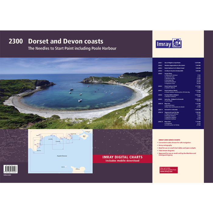
This fully revised and extended edition of our popular 2300 Dorset and Devon Coasts chart pack has been redesigned and expanded to 13 sheets and includes improved coastal coverage throughout.
The latest official UKHO data has been used and combined with additional information sourced from Imray''s network to make it ideal for small craft. The chart pack includes all the navigational charts and tidal data for passage, approach, and mooring, and is designed to be used alongside The Shell Channel Pilot by Tom Cunliffe.
2300.1 Isle of Wight to Start Point (1:375 000)
2300.2 Western Approaches to the Solent (1:60 000)
2300.3 Poole Harbour to St Alban''s Head (1:60 000)
2300.4 St Alban''s Head to Portland Bill (1:60 000)
2300.5 Dorset Plans
Plans: Weymouth Harbour (1:7500), Lulworth Cove (1:4500), Worbarrow Bay (1:15 000), Swanage Bay (1:12 500), Portland Harbour (1:20 000), Chapman''s Pool (1:14 500)
2300.6 Poole Harbour (East) (1:17 000)
Plan: Salterns Marina (1:7500)
2300.7 Poole Harbour (West) (1:17 000)
Plan: Poole Harbour continuation of Holes Bay (1:17 000)
2300.8 Portland Bill to Bridport (1:100 000)
Plan: Bridport Harbour (1:5000)
2300.9 Lyme Bay - Bridport to Exmouth (1:100 000)
Plan: Lyme Regis (1:10 000)
2300.10 River Exe (1:21 500)
Plans: Exmouth Dock (1:7500), River Exe continuation to Exeter (1:21 500)
2300.11 Exmouth to Salcombe (1:100 000)
2300.12 Teignmouth & Tor Bay (1:50 000)
Plan: Teignmouth Harbour (1:12 500), Torquay Harbour (1:7700), Paignton Harbour (1:7500), Brixham Harbour (1:10 000)
2300.13 River Dart (1:15 000)
Plans: Kingswear (1:6250), River Dart continuation to Totnes (1:27 500)


Featured Products

Explorer Chartbook Near Bahamas 11th Ed.
Special Price
$89.95
Regular Price
$99.92

Italian Waters Pilot Revised 11th Edition
Special Price
$89.95
Regular Price
$94.93

Waterway Guide Northern 2024
Special Price
$52.99
Regular Price
$54.92